
Table of Contents
Only a few years ago I was travelling full time without a mobile phone or GPS device. I used a lot of paper maps and also saved screenshots from Google Maps to determine when I needed to make turns.
At the time there was an online bike route planner called Cycle Route that I used to calculate all my climbing, descending and average gradients along the way. Everything was shown on both a map and as an elevation profile. It was perfect for my needs and so simple that anyone could use it.
Unfortunately, Cycle Route no longer works, but I’ve just discovered an online mapping app called Bike Roll that does all the same stuff and more. BikeRoll seems to me to be the quickest, easiest bike routing software with usable elevation data.
Let’s take a closer look.

What Tasks Can BikeRoll Perform?
– Create a route between two points with elevation profile
– Check the length and amount of climbing on the route
– Choose between on-road and off-road routes
– Quickly gauge the difficulty of the ride
– Check the weather forecast for the ride
– Save the route
– PDF summary with key information, turn-by-turn cues, elevation profile
– Export the route as a GPX file
How To Create A Route Using BikeRoll
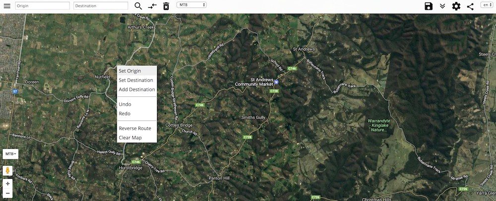
There are two ways to start making your route. You can either type an address, suburb or city in the ‘origin’ field OR you can right-click with your mouse on the map where you’d like to begin the route, and ‘Set Origin’. I’ve found that typing the location in can be a bit hit and miss, especially for places you’ve never been before.
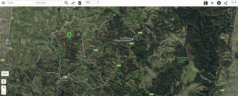
You can modify/move the start point around by clicking on and dragging the ‘A’.
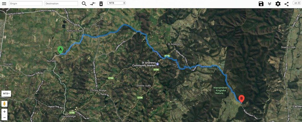
Next, you can set your destination by right-clicking ‘Set Destination’ with your mouse. You will now have generated a route from start to finish.
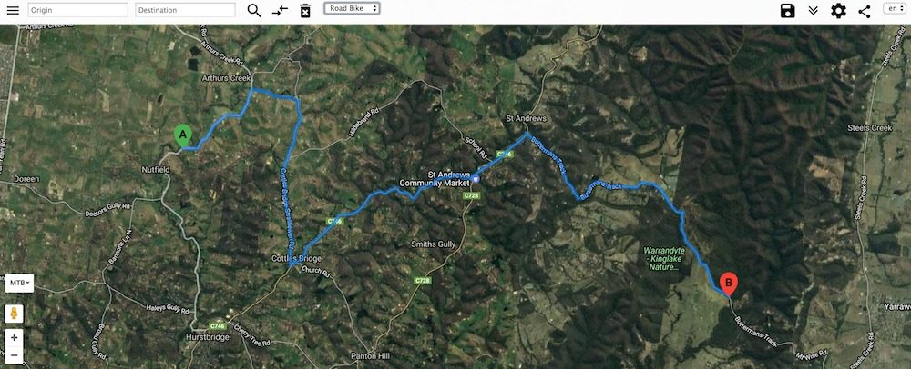
You will then have three different routing options: Google Bike, MTB and Road Bike. You can find these options in the middle of the upper menu. The mapping software can either use as much of the Google Bike network as possible, use all trails including off-road paths, or sticks to the fastest way on the road. I normally check all three options to see how the routes differ.
Modifying A Route With BikeRoll
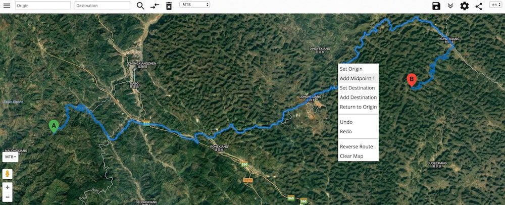
Ok, so creating the route wasn’t too hard. But how can we modify it? That’s easy. It’s all about midpoints. Simply right click your mouse to add them at the locations you’d like to pass through. But take note: I hit a midpoint limit at 24. If you need to modify the route more than that, then you’ll need to look into software like RideWithGPS which allows you to modify your route almost infinitely.
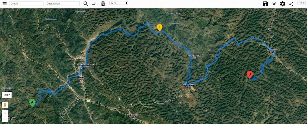
Again, you can move the midpoint locations to ‘pull’ the route where you’d like it to go.
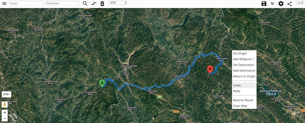
Made a mistake? Just right click and ‘undo’ or ‘redo’.
Understanding The Elevation Profile
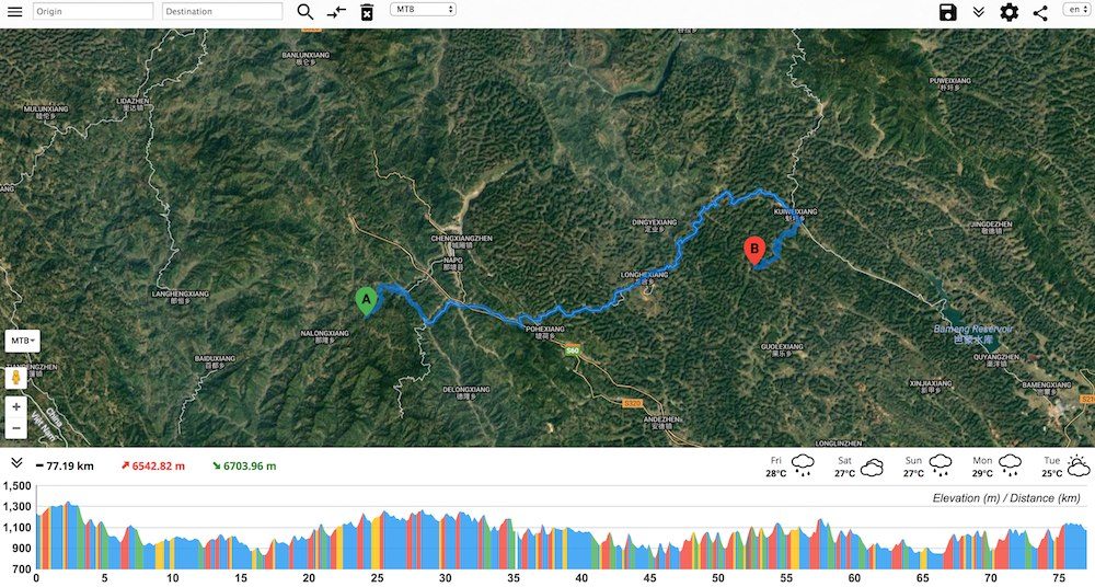
You’ll have noticed that BikeRoll provides an elevation profile below the map. This gives you with the key information about the distance and elevation gained/lost over your route.
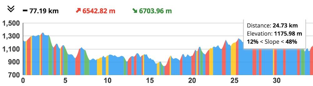
You’ll also see the gradient data is colour-coded. This has been designed in a way to determine how hard your route will be from a quick glance. If the whole route is blue for example, you will not encounter a climb over 5.9%, and therefore your ride will mostly be flat/undulating. Routes that show red are going to be really tough, so make sure you have the appropriate bike gearing!
Green: Greater than 20% gradient descent
Blue: Between -20% and +6% gradients
Yellow: Between +6% and +12% gradient ascent
Red: Between +12% and +48% gradient ascent
Black: Greater than 48% gradient ascent
You can hover your mouse over sections of the elevation profile to see the exact slope, distance and elevation data, along with where that climb/descent is located on the map.
Save and Export With BikeRoll
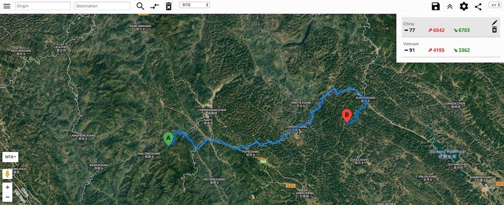
It’s easy to save your routes to view them later. You can either use Facebook or your Gmail account to do this. The saved routes appear in a list from the top-right menu for later.
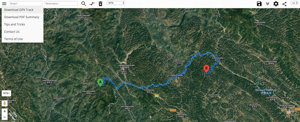
If you’re happy with your route, you can export it as a GPX file. Just click the three horizontal lines on the left-top corner and hit ‘Download GPX Track’. It will automatically download from here. You can then use your file in many smartphone apps or on your dedicated GPS device.
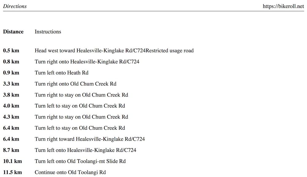
There’s an option to get a PDF summary of your route. This includes printable turn-by-turn cues with distance intervals, as well as the elevation profile and total distance.
Other Things To Note
– You can use BikeRoll on your smartphone in your internet browser. There is full functionality and no app download required.
– The distance units can be changed between miles and kilometres in the settings.
– There’s a weather forecast in the elevation profile to pick a suitable day to ride your route.
– You can choose a suitable language in the top-right corner.
Click HERE For A Tutorial On RideWithGPS: The More Advanced Online Route Planner
This is very cool, thanks for the heads up!
Just tried this (for a UK route) and the routing engine is poor. For a ride I often do, about 25 miles, both the ‘MTB’ and ‘Google’ routes use off-road tracks; the ‘Road’ options assumes you’re in a car and takes you on the biggest fastest roads. So no suitable route for most road cyclists. For Europe I recommend cycle.travel, which also now appears to cover USA although I can’t vouch for the quality of its routes choices there.
It will be a bit hit and miss depending on the region and the data they have for it. The Cycle.Travel website looks awesome! I’ll have to try it next time I’m in the UK or USA.
Hi Alee. I just tested 6 websites (to plot a planned 2000 km tour through Europe) and easily the best was Openrouteservice.org/directions. Cheers
Hello Alee,
I did a test to check Bikeroll and unfortunately it is approximate: from Udine (Italy) to Gibraltar would send me into the sea!
Usually I use Bikemap (http://cycle.travel/map) and Cycle route planner
(http://cycle.travel/map): the first one because I can schedule the stops and the second because I see the elevation profile.
Thanks anyway for your advice!
Bonny
openrouteservice.org gets my vote too.