

Sick of your job? Looking for a huge challenge? Why not take a year off, pack everything into some panniers and complete this year-long, USA bike tour with perfect cycling temperatures every day?
I recently set myself the challenge to create a year-long bike tour around the USA that is optimised around the perfect cycling temperatures. I ended up spending way too much time geeking out on all of the details here, but what I’ve managed to create is pretty bloody cool (or rather, mild).
My ‘perfect’ cycling temperature is around 72 degrees Fahrenheit (22 degrees C). This is a temperature that allows me to wear light clothing while I ride with zero risk of overheating. I can also typically pack a bit lighter, and get comfortable overnight sleeps in my tent too.
It’s worth noting that this map is designed around the average maximum temperature per day, so you’ll find the overnight temperatures will still drop below 30 degrees F (-1 C) in many of the mountain and desert regions.
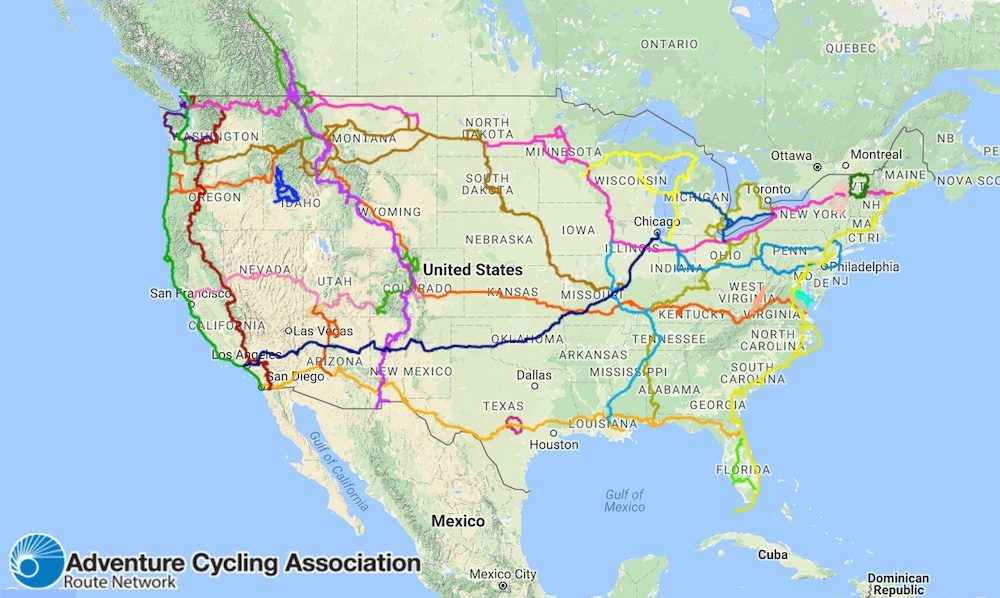
The 12,679mi (20,286km) USA Bike Tour With Perfect Weather

This route traverses 27 different states and averages:
– 72 degrees F / 22 degrees C with minimal fluctuation
– 244mi (390km) per week
– 49mi (78km) per day over 5 days of cycling
– 61mi (98km) per day over 4 days of cycling
The 27 states that you will tick off:
California-Arizona-New Mexico-Texas-Louisiana-Mississippi-Alabama-Florida-Georgia-South Carolina-North Carolina-Virginia-Maryland-Pennsylvania-Ohio-Indiana-Michigan-Wisconsin-Minnesota-North Dakota-Montana-Washington-Oregon-Idaho-Wyoming-Colorado-Utah
How Did I Create The Perfect Weather Cycling Route?
We have so many amazing tools at our fingertips which help us determine everything from road surfaces to average weather conditions. The aim of this exercise was to show you what kind of travel planning is possible with the resources we have on hand.
I started by analysing the Adventure Cycling Association Interactive Network Map. For the last 40 years, ACA has been inspiring and empowering people to travel by bicycle. They now have dozens of long-distance bike routes, complete with detailed bike touring maps that you can purchase which cover every mile. That takes the majority of the guesswork out of your trip planning.
I then used Holiday Weather to get a general idea of the monthly average high temperatures in multiple locations on one map. You can select any month of the year and it will show you the average temperatures for multiple locations across a continent.
To check the average high temperatures at really specific locations, I used US Climate Data. This website has the resources available to get weather data for most cities and towns along the way. You can read my guide on weather planning HERE.
There were two or three very short sections on this route that I mapped on Google Maps using bicycle routeing. This is because there wasn’t an ACA route for all of the places I required this map to go.
Monthly Itinerary
January
Southern Tier Route
San Diego, California (18C/64F) – Tempe, Arizona (27C/81F) – Fort Davis, Texas (23C/73F)
Total: ~1160mi / ~1856km
The year-long USA bike tour route has you heading out of San Diego at the start of January. You will be travelling east along the Southern Tier Route up into the mountains topping 3800ft (1158m), before dropping into desert country. The route takes you below-sea-level through the Imperial Valley, then you’ll split the dry Algodones Dunes Wilderness Area in half. This sparsely-populated region of the USA will make every town a welcome sight – don’t forget to top up your water supplies while you’re there. Stop in Silver City for a nice coffee, and at the Gila Cliff Dwellings National Monument to appreciate some of the best-preserved Mogollon cliff dwellings around.
February

Southern Tier Route
Fort Davis, Texas (24C/75F) – Navasota, Texas (24C/75F) – New Roads, Louisiana (24C/75F)
Total: ~1045mi / ~1672km
Texas takes up one-third of the Southern Tier Route, and luckily for us, this section is best tackled in February. You’ll head through the Davis Mountains where some of the friendliest folk on the route reside. At the McDonald Observatory on Mt Locke, you can observe the night sky on one of their evening tours. Texas gets a little more desolate after this, with sagebrush and tumbleweeds rolling about all the way to the ‘hill country’ region of the state. In Austin, spend a bit of time listening to the diverse live music that the city is famous for.
March
Southern Tier Route
New Roads, Louisiana (24C/75F) – Mobile, Alabama (24C/75F) – St Augustine, Florida (25C/77F)
Total: ~853mi / ~1365km
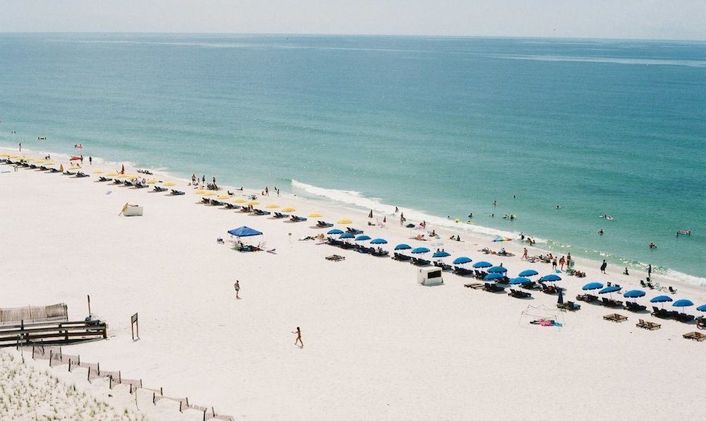
The history, culture and food in Louisiana are different from all other states. You’ll be heading right through Cajun country where English is spoken, but you’ll need to focus as it’ll be a little harder to understand the words. Also, try to catch some lively Cajun music if you can. It’s rural riding all the way into Alabama where the route crosses to Dauphin Island. A ferry ride across Mobile Bay will take you to some of the whitest beaches in the world. The scenery is rather varied all the way across Florida to St Augustine.
April

Atlantic Coast Route
St Augustine, Florida (25C/77F) – Wilmington, North Carolina (21C/70F) – Washington DC (19C/66F)
Total: ~1184mi / ~1895km
Welcome to the Atlantic Ocean! It’s beach riding all the way up Florida from the oldest European settlement in the United States (St Augustine) right up to Jacksonville. In Georgia, it’s farm and swamp country; the best swamp of them all is at the Okefenokee National Wildlife Refuge. It’s one of the largest swamps remaining in the nation where you can go on boat rides and boardwalks over the marshes where you’ll see alligators of all sizes. The winds can be strong through Virginia which may be the reason the Wright Brothers flew their first plane there. You’ll soon pass Mount Vernon, George Washington’s residence from 1754 until his death, before riding a series of beautiful bike paths towards Washington DC.
May
Custom + Chicago to NY + UGRR Pittsburgh Spur + Northern Tier + Northern Lakes Route
Washington DC (19C/66F) – Pittsburgh, Pennsylvania (22C/72F) – Ludington, Michigan (25C/77F)
Total: ~1144mi / ~1830km
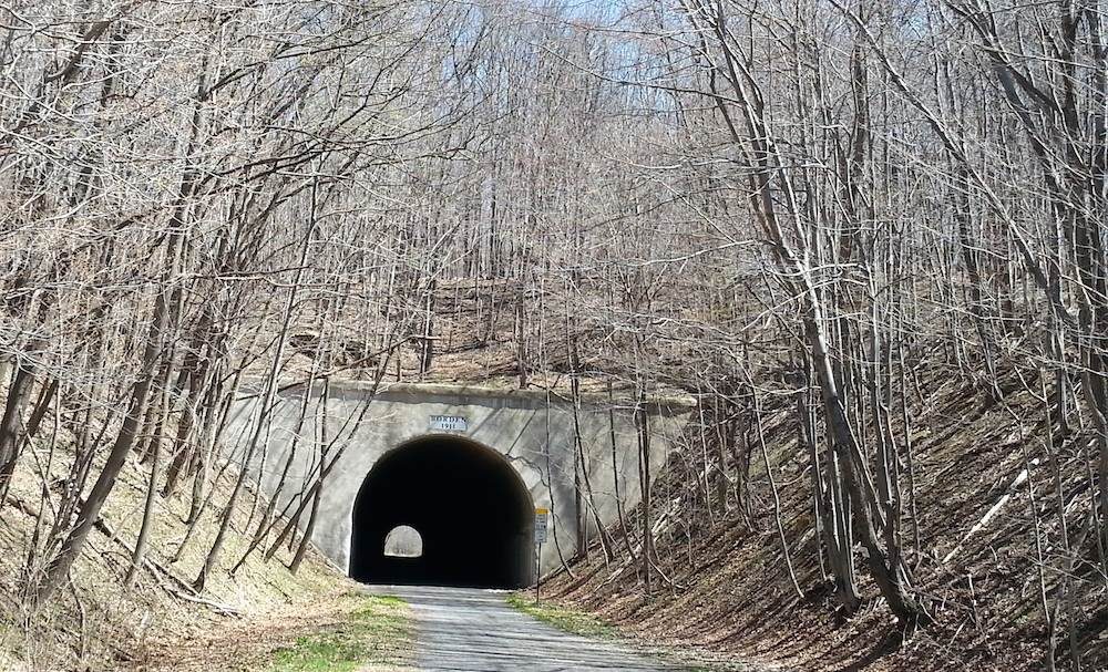
It’s a short section away from the ACA touring network from Washington DC, but you’ll soon hit the Chicago to NY Route. Heading into the Eastern Continental Divide you’ll need some lights as there are a series of unlit tunnels ranging from 849 to 3294 feet (1000m) in length, as the trail utilises much of the existing rail infrastructure. You’ll travel along the historic Mason-Dixon Line on the Pennsylvania and Maryland border which was known as the symbolic divide between the Northern and Southern states during the Civil War. Near Ohiopyle State Park you can expect significant bicycle and pedestrian traffic. This is a popular white water rafting and outdoor recreation destination, especially approaching summer.
The Underground Railroad Bicycle Route (UGRR) from Pittsburgh memorialises the secret network of routes that African freedom seekers used to escape slavery before and during the Civil War. The UGRR finishes at Lake Erie where you’ll head west on the Northern Tier Route, passing the prairie farms of Ohio and Indiana. You’ll soon be at the Lake Michigan where you can follow small rural roads along the lakeshore.
June

Northern Lakes + Northern Tier Route
Ludington, Michigan (25C/77F) – Fargo, North Dakota (26C/79F) – Saco, Montana (26C/79F)
Total: ~1290mi / ~2064km
You’ll cross Lake Michigan by ferry from Ludington to Manitowoc. Wisconsin and Minnesota stand out as some of the greenest and lushest states along this northern sector. You’ll pass through hardwood forests and dairy farmland before connecting back up to the Northern Tier Route which is all hills, forests, lakes and rivers. The birthplace of the Mississippi River is at Lake Itasca State Park on the way to North Dakota. The river flows for 2552 miles (4107km) into the Gulf of Mexico! The route follows the I-94 corridor, alternating between the freeway and parallel county roads all the way to Montana.
July

Northern Tier Route
Saco, Montana (26C/79F) – Libby, Montana (32C/90F) – Anacortes, Washington (23C/73F)
Total: ~1176mi / ~1882km
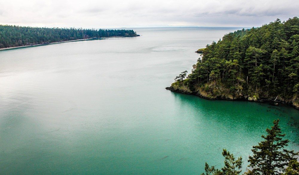
The Great Plains of Montana are soon met with the eastern slopes of the Rocky Mountains at Cut Bank. The Northern Tier Route will take you into the mountains, where you’ll find the valleys run in a north-south direction, and because the route travels east-west, you’ll be working your way up and over the ponderosa pine passes. There are endless towns, rivers, lakes, mountains and forests towards the Cascade Mountains where you’ll need to tackle two more passes: Rainy Pass and Washington Pass. You’ll finally hit the Pacific Ocean at Anacortes, seven months since you last saw it.
August
Pacific Coast + Lewis and Clark Trail + Trans Am Route
Anacortes, Washington (23C/73F) – Lewiston, Idaho (31C/88F) – Missoula, Montana (26C/79F)
Total: ~910mi / ~1456km
The Pacific Coast Route takes you from Anacortes over to Whidbey Island and down the Olympic Peninsula. You can actually catch a ferry all the way into Seattle from here. At Castle Rock, a five-mile side trip leads to the Mount St. Helens Visitor Centre, which tells the tale of the volcano’s eruption in 1981. It’s logging country down towards Portland where you’ll now join the Lewis and Clark Trail. There are a few closed-to-cars sections of the Historic Columbia River Highway which lead you to some small, serene communities that barely earn a dot on the map. From Lewiston, you’ll head into the Nez Perce Indian Reservation and onto Highway 12 and the Trans Am Route. The route follows the Lochsa River for the longest gradual ascent of the Trans Am of 70 miles (112km) up to Lolo Pass and down to Missoula. You’ll be able to visit the Adventure Cycling headquarters and their “cyclist’s lounge” in Missoula! Beautiful panoramas, wide valleys and mountain passes await you in this part of Montana.
September

Trans Am + Great Parks South Route
Missoula, Montana (26C/79F) – Lander, Wyoming (23C/73F) – Ridgway, Colorado (18C/64F)
Total: ~1105mi / ~1768km
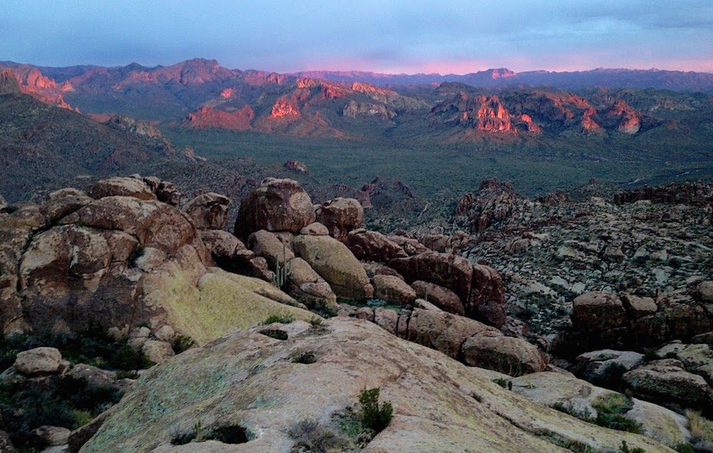
The Trans Am Route leads you to the amazing views of Yellowstone National Park and of the Grand Teton Range. Make sure to spend a few days exploring what these two national parks have to offer. The towns of Dubois and Lander present historic architecture and western-style cooking. In the Great Divide Basin, you’ll find Lamont which can serve up a great bowl of chilli. The scenery then changes from dry desert to the alpine region as you cross into Colorado. You’ll begin the long climb to crest Hoosier Pass at 11,542ft (3518m) before taking the Great Parks South Route through old mining country across to Ridgway, Colorado.
October
Great Parks South + Western Express + Grand Canyon Connector + Bicycle Route 66
Ridgway, Colorado (18C/64F) – Kanab, Utah (22C/72F) – Amboy, California (21C/70F)
Total: ~1177mi / ~1883km
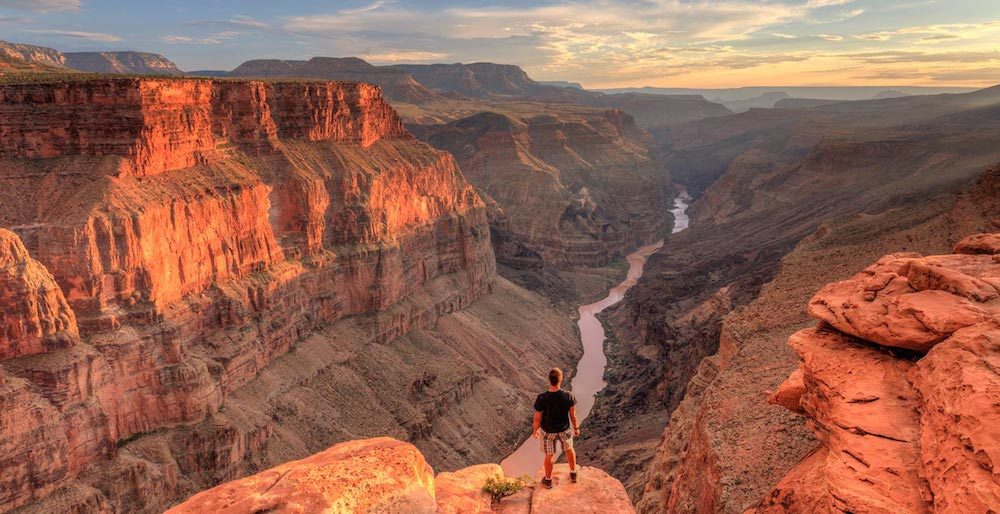
The Great Parks South Route takes you on smooth tourist roads out of the Rockies and into some of the USA’s most spectacular scenic wonders. Along the Western Express Route, you’ll explore many national parks that feature all kinds of natural sculptures, spires, buttes and canyons. You’ll then travel through Zion National Park and across to the north rim of the mind-blowingly large World Heritage Site that is the Grand Canyon. These national parks are bicycle-friendly, meaning you’ll get to ride along popular sections where visitors in cars must use shuttle buses. Given the time of year, there should be less tourist traffic and milder weather conditions than peak season. The Bicycle Route 66 will take you across Arizona to California, but be warned this is a long desert stretch with very limited services.
November
Bicycle Route 66 + Sierra Cascades Route
Amboy, California (21C/70F) – Lemon Cove, California (20C/68F) – Sorensens, California (9C/48F)
Total: ~800mi / ~1280km
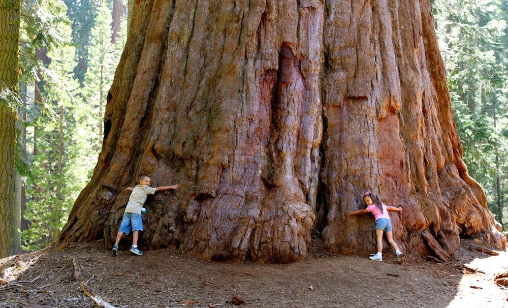
Heading west along Bicycle Route 66 you’ll be heading for the Pacific Ocean, but it will still be a month before you actually see waves. This route takes you up the Sierra Cascades from the San Gabriel Mountains just outside Los Angeles, all the way up to Lake Tahoe which is east of San Francisco. Along the way, you’ll discover the Trail of a Hundred Giants at Sequoia National Forest, as well as the lakes and mountains of Kings Canyon NP. There’s a chance that Tioga Pass just out of Yosemite NP will close mid-November if it’s a heavy snow year, so make sure to keep up to date with the conditions. Alternatively, you might need to follow the western Sierra Nevada foothills towards Sacramento.
December
Western Express + Pacific Coast Route
Sorensens, California (9C/48F) – San Francisco, California (16C/61F) – Imperial Beach, California (20C/68F)
Total: ~833mi / ~1333km
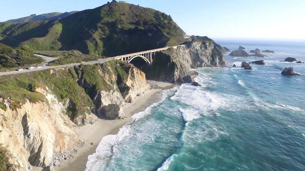
It’s now time to depart the Sierra Nevada by jumping on the Western Express Route that cuts through the agricultural valleys down to San Francisco. You’ll get the opportunity to ride over the Golden Gate Bridge into San Francisco, then you’ll follow the western edge of the city to the numerous state beaches. It’s almost elephant seal mating season at Ano Nuevo State Reserve; it’s a sight not to be missed. The Pacific Coast south of Carmel is the most spectacular sector for many cyclists. The winding road high above the ocean offers incredible views, and because you’re heading south you’ll be on the right side of the road! It’s fertile farming land as you approach Santa Barbara, and seaside trophy homes as you approach the Los Angeles megapolis. Bike paths will take you through LA before rejoining the Pacific Coast Highway south of the city. There’s a mix of highways, bike paths and shore roads to the Coronado ferry in San Diego where you will finish your year-long USA tour at the Mexican border.
Is There A Way To Make This USA Bike Tour Even Better? I’d Love To Hear.
This is such an epic post! Thanks so much for laying it out so easily and with so much research. We’ll be sure to let you know if we do it!! It’s got me planning from my desk already ;p
Wow, amazing post. Will definitely use this when planning my trans-am in 2018.
Don’t forget to check which way the wind is most likely to travel too. 🙂
I would ride North more in Michigan to go across the Mackinaw Bridge into the UP and then go over into Wisconsin from there. The Northern part of the LP of Michigan is great for bike riding.
I have read that there are prevailing West-East wind direction so that starting in the Wast should be a bit easier. Was that your experience also?
Awesome route planning! I started in San Diego on 2 Jan 2006 and finished in San Diego on 31 Oct 2006. Southern Tier, East Coast and into Canada a bit. Northern Tier from Quebec City up Michigan to the UP, then Northern Tier again to Bellingham, WA, then Pacific Coast back to San Deigo. I think one would be further along than Michigan by June based on this route and the winds and elevation in the west might extend the trip a bit. Great challenge for sure! The night time temps are no joke! Had ice inside my tent some nights in the SW. Heat waves along the Great Plains with temps above 100 for over a week in late June and just missed the snow in Glacier in Sep. Timing the route to hit the Going to the Sun Road in Sep was ideal. Again, awesome post!
Agree about hitting the UP. Definitely beautiful riding.
https://uploads.disquscdn.com/images/628ab01f5d0ccdce89e0ae9e57f8f01903fdb2c60d9cf4639725494b43c1dcea.jpg
East side of Glacier NP.
Thanks for Sharing. Wow!! Hope you continue the journey safe and soundly too
Personally, I’d keep going up the Lake Michigan coast, then cross to the Upper Peninsula before continuing west to Wisconsin. I’ve done both routes – on a 50cc scooter, because I’m lazy 🙂 – and they’re both nice territory, but I prefer Northern Lower MI and the UP.
You missed Iowa. That just won’t do.
At the end of that year you could keep going south along the Baja Divide.
Alee, I have been dreaming up a trip like this myself. Really great work. I will say though, having biked from San Diego CA to El Paso TX December 26th 2006 through January 11th 2007 on the Southern Tier ACA route, that you will need cold weather gear if you want to bike in the mornings. I awoke numerous times to 22 degrees and thick frost on my tent. It took until about 10:30 a.m. for the temperature to be bike-friendly. But that is no reason to not attempt your epic route.
That would be awesome!
You’re right that November will have some pretty cold starts in the mountains! It’s an average temperature map, and most of the data is only available in the built-up areas. 🙂
I did a cross country ride years ago, across Canada and the US. . . this planned ride of yours looks amazing! Are you going to blog about it anywhere?
I’ll always write about and film my adventures!
Of course. . . I found this post via reddit, I’ve never visited this site before. 🙂
Amazing post, thank you so much!! Had been pouring over the USA routes myself and trying to figure out best way around, this post it is just perfect!! Also enjoying other people’s suggestions <3
Glad it’s all coming together for you. 🙂
Small mistake, Trail of a Hundred Giants is actually in Sequoia national forest not the national park.
Thanks. Just amended it.