

My preferred method of navigation is using a smartphone due to the fact they are so easy and intuitive. I can quickly download detailed maps of any country in the world that are easy to move, zoom in and out, and create points of interest on.
GPS Navigation: Bike Touring or Cycling With a Smartphone
The Best Apps for GPS Navigation on a Smartphone
The Best Bike Smartphone Cases & Mounts for Cycling
My go-to app for navigation with my Apple iPhone 5S is Maps.me. It’s maps are used with no Internet connection, it’s super straight forward, it includes points of interest and even has offline routing.
In order to save my battery, I never use turn-by-turn navigation or leave the screen on for long periods of time. I like to use KML files which show my routes as lines on maps. I tend to use my smartphone more like a paper map, switching it on/off whenever I need to check if I’m still en route and heading the right way. I can sometimes go for days without a battery charge if I use it in this manner!
I design my routes in various ways (HERE is my tutorial using RideWithGPS), then go about the following process to get the routes into the app.
1. Email the KML/KMX file that I’ve created to myself.
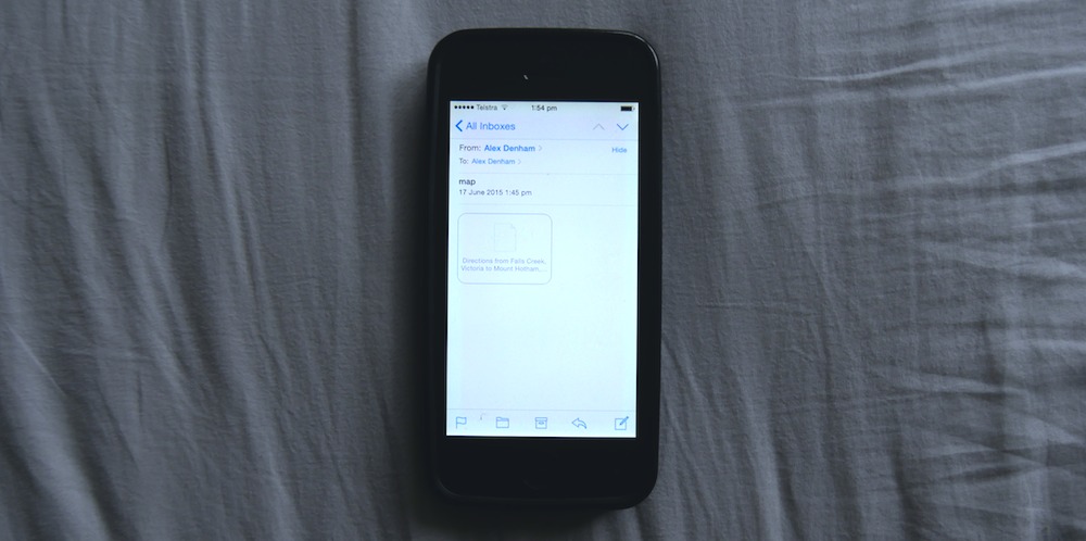
2. Press and hold the KML file for one second, until I can choose which app to launch it from. I select Maps.me.

3. Maps.me opens up and the bookmark loads.
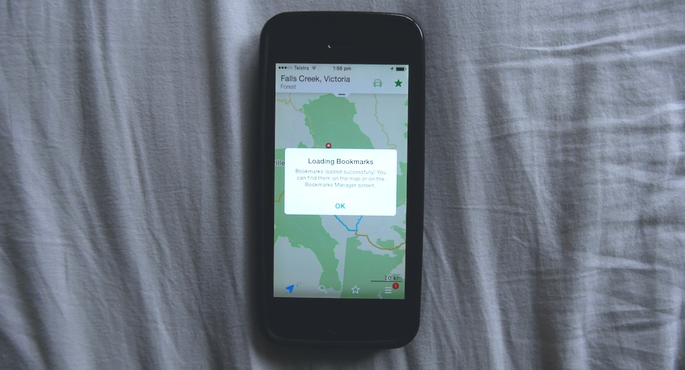
4. I can now view my KML route in my app.
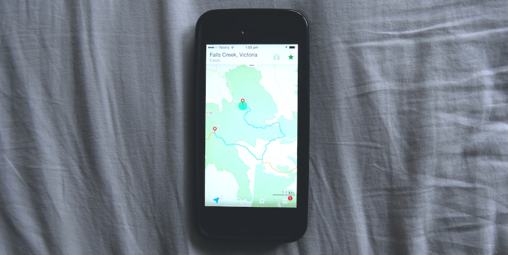
5. If I need to turn the KML route layer on or off, I click the star at the bottom of the screen and that takes me to my bookmarks. This is where my routes live.

You completely missed the most important part: how to start the navigation feature for the imported KML route. The reason: MAPS.ME cannot do this, and can only do navigation when you specify a start & dest within the app, completely defeating the purpose of doing all that work with the KML.
FWIW the KML does just put a track (bookmark) layer on the map, it’s not a way to create an automated nav route that MAPS.ME will prompt from. That said, at least for me, bike touring isn’t really about following the voice prompts of a GPS, its about taking the time to enjoy the adventure and I use the KML track as I would a line on a paper map and pull it out to consult it when I have questions about the route at a junction. If you want route prompting from RideWithGPS exports then you should buy a Garmin Edge and let it lead you, or use an exported GPX route or track file to create a route in a different mobile app, there’s a few out there that will let you do this (ie: Maverick or even Google Maps with some massaging of the export file).
I completely agree that Maps does not do that so I am all ears for your better solution. The reason you don’t have one: Because there isn’t a better solution than the one he gave great instructions on how to use. The KML maps are great in maps.me and there isn’t a better offline platform for navigation. Free too boot.
For me, turn-by-turn isn’t at all important. I just like having a line on my map. 🙂
There are different ways for biking. I used to be the old-fashioned guy preferring a paper or polymer map which I’d have to pull from my back pocket to check every now and then to orientate.
However, I have also found out that stopping at spots to check my route–usually traffic junctions–isn’t the safest thing to do. Also, having to check maps regularly may break your cycling cadence. Therefore, it would be nice if MAPS could assist keeping me on track or at least making me aware how far off the track I am. I wouldn’t turn it on permanently (if only for battery life)–just in cases I’d feel lost or when road sings are confusing.
I assume that Google maps does provide this feature via the cloud, but I prefer to use cloud-free solutions as much as possible.